Cornforth Consultants
  • Home
  • Services
    • Earth & Rockfill Dams
    • Reservoirs, Canals, and Levees
    • Spillway Safety Inspections
    • Landslides and Rockfall
    • Earthquake Engineering
    • Geologic Hazards
    • Geotechnical Site Characterization
    • Hydrogeology
    • Expert Witness
    • Concrete Dams and Locks
    • Geotechnical Instrumentation
    • Deep and Shallow Foundations
    • Geotechnical Manuals
  • Industries
    • Water Resources
    • Energy
    • Natural Resources
    • Industrial
    • Transportation
    • Ports and Airports
    • Expert Witness
  • Projects
    • Earth and Rockfill Dams >
      • Barney Reservoir
      • Frog Lake Reservoir
      • Iron Gate Dam Raise
      • McGuire Dam Raise
      • Bonneville Cofferdam
      • Bull Run No. 2 Seismic Stability Analysis
    • Levees and Canals >
      • Libby Dike Rehab.
      • St. Johns Dike Stabilization
      • Cowlitz River Levees
      • Swift Canal Failure
    • Earthquake Engineering >
      • Barney Dam Seismic Analysis
      • Fern Hill WTP Liquefacation Study
      • Bull Run No. 2 Seismic Stability Analysis
      • Mt. Tabor Seismic Stability Analysis
      • Port Westward Power Plant Seismic Design
    • Rock Slopes and Tunnels >
      • Libby Rockfall Mitigation
      • Sandy River Pipeline Tunnels
      • Ketchikan Third Avenue Extension
      • Sain Creek Water Supply Tunnel
      • Montana Rockfall Hazard Rating System
    • Foundations >
      • Port Westward Power Plant
      • Cascade Locks Casino
      • Air National Guard Hangar
      • Biglow Canyon Windfarm
      • Oakridge Water System Improvements
    • Concrete Dams and Locks >
      • John Day Lock & Dam
      • Marmot Dam Removal
      • The Dalles Dam
      • Willamette Falls Dam
      • Bonneville Dam
    • Transportation >
      • OTIA Cracked Bridge Geotechnical Baselines
      • Newburg Dundee Bypass Design DEIS
      • I-84 Sandy River Bridge Investigation
      • Tanana River Bridge Foundation, Tok, Alaska
      • Montana RHRS Implementation
      • Ketchikan Third Avenue Extension
    • Ports and Airports >
      • Navy CVN Drydock
      • Depoe Bay Seawall Distress
      • Willamette Falls Flow Control Structure
      • Air National Guard Hangar
    • Water and Wastewater >
      • Fern Hill Water Treatment Plant
      • Tualatin Valley North Transmission Line
      • Evaluation of 28 Water Storage Facilities
      • City of Sandy Water Treatment Plant
      • Mt. Tabor Reservoir No. 5 Cap Study
      • Oakridge Water System Improvements
  • Staff
  • Resources
  • Careers
    • Geotechnical Engineer
  • Contact Us

Depoe Bay Marina Seawall Distress

Depoe Bay, Oregon
On the east side of the Depoe Bay boat basin, a slow-moving landslide was tilting and deforming a structural sea wall that was originally built by the Portland District Corps of Engineers in 1939 and improved in 1952. The 750-foot long wall was designed as a gravity concrete retaining wall with a 21-foot height and a 13-foot base width. By 1993 the landslide had displaced the southern 200 feet of the wall 3 feet horizontally and ½ foot downward into the bay. Cracking and settlement were also impacting the City-owned pavement and utilities, including a main sewer line in the parking lot behind the wall. Long-term continuation of the slide movement was also a potential threat to the boat basin. In 1983 and again in 1995 the Portland District Corps of Engineers performed investigations and attempted to remediate the damage to the wall.

Under contract with the Portland District Corps of Engineers, Cornforth Consultants performed geotechnical investigations and analyses and confirmed that the wall distress was related to a landslide that was larger and deeper-seated than previously anticipated. It was moving on a slip surface that was deep within the mudstone bedrock foundation. Recurrent movement over the years was triggered by increased pore-water pressures within the landslide mass during periods of intense rainfall.

​Through traditional means of investigation and analysis, a non-traditional method was selected to stop the slide movement – a subsurface shear pile wall. Cornforth Consultants designed the wall, prepared plans and specifications, and provided engineering support during construction. The construction of the shear pile wall was successfully completed, within budget and schedule. Instrument measurements indicate that the landslide has stopped moving the seawall toward the bay.
Type 2 RHRS Slope on Highway 26
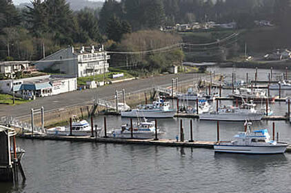
Depoe Bay Marina and Seawall

​Services Provided:

  • Review of geology and historic information
  • Site reconnaissance and landside mapping
  • Develop plan of explorations
  • Subsurface investigation
  • Instrumentation slope inclinometers and piezometers
  • Mapping landslide and historic impacts
  • Crack and settlement mapping
  • Analysis of landslide stability
  • Evaluation of pore-water pressure and precipitation
  • Evaluation of mitigation options
  • Cost comparison of remedial alternatives
  • Landslide stability design recommendations
  • Final design of shear pile wall
  • Plans and specifications
  • Geotechnical monitoring
  • Construction technical assistance and quality control
  • Home
  • Services
    • Earth & Rockfill Dams
    • Reservoirs, Canals, and Levees
    • Spillway Safety Inspections
    • Landslides and Rockfall
    • Earthquake Engineering
    • Geologic Hazards
    • Geotechnical Site Characterization
    • Hydrogeology
    • Expert Witness
    • Concrete Dams and Locks
    • Geotechnical Instrumentation
    • Deep and Shallow Foundations
    • Geotechnical Manuals
  • Industries
    • Water Resources
    • Energy
    • Natural Resources
    • Industrial
    • Transportation
    • Ports and Airports
    • Expert Witness
  • Projects
    • Earth and Rockfill Dams >
      • Barney Reservoir
      • Frog Lake Reservoir
      • Iron Gate Dam Raise
      • McGuire Dam Raise
      • Bonneville Cofferdam
      • Bull Run No. 2 Seismic Stability Analysis
    • Levees and Canals >
      • Libby Dike Rehab.
      • St. Johns Dike Stabilization
      • Cowlitz River Levees
      • Swift Canal Failure
    • Earthquake Engineering >
      • Barney Dam Seismic Analysis
      • Fern Hill WTP Liquefacation Study
      • Bull Run No. 2 Seismic Stability Analysis
      • Mt. Tabor Seismic Stability Analysis
      • Port Westward Power Plant Seismic Design
    • Rock Slopes and Tunnels >
      • Libby Rockfall Mitigation
      • Sandy River Pipeline Tunnels
      • Ketchikan Third Avenue Extension
      • Sain Creek Water Supply Tunnel
      • Montana Rockfall Hazard Rating System
    • Foundations >
      • Port Westward Power Plant
      • Cascade Locks Casino
      • Air National Guard Hangar
      • Biglow Canyon Windfarm
      • Oakridge Water System Improvements
    • Concrete Dams and Locks >
      • John Day Lock & Dam
      • Marmot Dam Removal
      • The Dalles Dam
      • Willamette Falls Dam
      • Bonneville Dam
    • Transportation >
      • OTIA Cracked Bridge Geotechnical Baselines
      • Newburg Dundee Bypass Design DEIS
      • I-84 Sandy River Bridge Investigation
      • Tanana River Bridge Foundation, Tok, Alaska
      • Montana RHRS Implementation
      • Ketchikan Third Avenue Extension
    • Ports and Airports >
      • Navy CVN Drydock
      • Depoe Bay Seawall Distress
      • Willamette Falls Flow Control Structure
      • Air National Guard Hangar
    • Water and Wastewater >
      • Fern Hill Water Treatment Plant
      • Tualatin Valley North Transmission Line
      • Evaluation of 28 Water Storage Facilities
      • City of Sandy Water Treatment Plant
      • Mt. Tabor Reservoir No. 5 Cap Study
      • Oakridge Water System Improvements
  • Staff
  • Resources
  • Careers
    • Geotechnical Engineer
  • Contact Us